Our Team
Principal Investigators
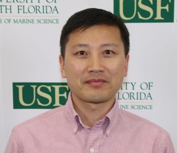
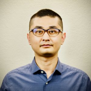
Steven Murawski, PhD
PI
Murawski has over 45 years of experience as a marine scientist and science administrator. He had a 35-year career at NOAA last serving as the Chief Scientist of NMFS where he oversaw a staff of 2,500, a $420 million per year budget, and the operations of 11 research vessels. Since coming to the University of South Florida, Steve has been PI on >$45 million in grants including the Center for Integrative Modeling and Analysis of Gulf Ecosystems (C-IMAGE), and the Continental Shelf Characterization, Assessment and Mapping Project (C-SCAMP).
En Español
Steven Murawski, PhD
Investigator Principal (PI)
El Doctor Murawski tiene más de 45 años de experiencia como científico marítimo. Tuvo una carrera de 35 años con la Oficina Nacional de Administración Oceánica y Atmosférica (NOAA) como Director Científico del Servicio Nacional de Pesquerías Marinas (NMFS), donde estuvo a cargo de un equipo de 2500 personas, un presupuesto de $420 millones de dólares por año, y las operaciones de 11 buques de investigación. Después de unirse a la Universidad del Sur de la Florida (USF), Steve ha sido investigador principal de proyectos con subsidios de más de $45 millones, incluyendo el Centro de Modelaje y Análisis Integrativo de los Ecosistemas del Golfo (C-IMAGE) y el Proyecto de Mapeo, Evaluación y Caracterización de la Placa Continental (C-SCAMP).
Tim Dixon, PhD
Co-PI
Tim Dixon is the Principal Investigator on the SUBGEO project, the NSF-funded program to develop and deploy geodetic spar buoys. Dixon is a Distinguished University Professor in the School of Geosciences, USF, and has 35 years experience in marine and terrestrial geodesy, including satellite radar altimetry, GPS/GNSS, and surface and satellite based radar interferometry. Dixon oversees enhancements to the geodetic spar buoy project and also leads ongoing work looking at new approaches to precision sea level measurement and testing GPS-GNSS systems.
En Español
Tim Dixon, PhD
Coinvestigador Principal (Co-PI)
Tim Dixon es el investigador principal del Proyecto SUBGEO, un programa financiado por la Fundación Nacional de Ciencias (NSF) para desarrollar y desplegar boyas geodésicas de tipo “spar” al mar. Dixon es un “Profesor Distinguido Universitario” de la Escuela de Geociencias, USF, y tiene 35 años de experiencia en geodesia marítima y terrestre, incluyendo altimetría radar satelital, GPS/GNSS, e interferometría satelital y de superficie.
Cheryl Hapke, PhD
Co-PI
Hapke is a coastal geologist with over 25 years of experience in studies of coastal geomorphology, coastal change hazards, and application of state-of-the-art mapping techniques, both field and remote-sensing based. She had a 22-year career at the USGS, serving as a senior research geologist overseeing national-scale projects including a $4.2 million dollar effort to conduct extensive multi-year mapping after Hurricane Sandy along the NY coastline. Cheryl served as the director of the USGS St Petersburg Coastal Science Center before coming to USF-CMS. Dr. Hapke is also the lead organizer for the Florida Coastal Mapping Program (FCMaP).
En Español
Cheryl Hapke, PhD
Coinvestigadora Principal (Co-PI)
Hapke es geóloga costera con más de 25 años de experiencia en estudios de geomorfología costera, peligros de cambio costeros, y aplicación de técnicas cartográficas de alta generación, basados tanto en el campo como en la teledetección. Tuvo una carrera de 22 años con el Servicio Geológico de Estados Unidos (USGS), desempeñándose como geóloga investigadora senior supervisando proyectos a nivel nacional, incluyendo un esfuerzo de $4.2 millones de dólares para llevar a cabo un extenso mapeo de varios años después del huracán Sandy a lo largo de la costa de Nueva York. Cheryl fue directora del Centro de Ciencias Costeras de San Petersburgo del USGS, antes de unirse a USF-CMS (Centro de Ciencias Marinas de USF).
Chad Lembke, M.M.E.
Co-PI
Mr. Lembke is a Research Faculty member who has been responsible for various mechanical and systems engineering projects for USF-CMS. Since 1998, Lembke has been involved in prototype engineering, fabrication, and utilization of dozens of sensors, instruments, and platforms designed for use in the oceanographic environment, including coastal profiling floats, ROVs, AUVs, buoys, underwater mass spectrometers, and other chemical and biological sensors. More recently his focus has been the utilization of underwater gliders, towed video, and shipboard sonar systems in collaboration with scientists to these technologies in tandem to enhance fisheries stock assessment data collection.
En Español
Chad Lembke, M.M.E.
Coinvestigador Principal (Co-PI)
El Sr. Lembke es miembro de la Facultad de Investigación y ha sido responsable de varios proyectos de ingeniería mecánica y de sistemas para USF-CMS. Desde 1998, Lembke ha estado involucrado en la ingeniería de prototipos, fabricación y utilización de docenas de sensores, instrumentos y plataformas diseñadas para su uso en el entorno oceanográfico, incluyendo flotadores de perfil costero, ROVs, AUVs, boyas, espectrómetros de masas submarinos y otros sensores químicos y biológicos. Recientemente, su enfoque ha sido la utilización de planeadores submarinos, video remolcado y sistemas de sonar a bordo de barcos en colaboración con científicos para utilizar estas tecnologías en conjunto y mejorar la recolección de datos para la evaluación de existencias de peces
Yonggang Liu, PhD
Co-PI
Dr. Yonggang Liu has 20 years research experience in ocean circulation on the West Florida Shelf, Gulf of Mexico, using both in-situ observations and numerical models. He is interested in applying physical oceanography to marine environmental issues, such as oil spill tracking and red tide predictions. He also develops and applies novel data analysis methods in meteorology and oceanography. For the COMIT project, he will run the suite of nested models and assist Dr. Weisberg with all aspects of the ocean circulation applications.
En Español
Yonggang Liu, PhD
Coinvestigador Principal (Co-PI)
El Dr. Yonggang Liu tiene 20 años de experiencia en investigación de circulación oceánica en la Plataforma Oeste de Florida y el Golfo de México, utilizando tanto observaciones in-situ como modelos numéricos. Está interesado en aplicar la oceanografía física a cuestiones medioambientales marinas, como el seguimiento de derrames de petróleo y las predicciones de marea roja (Red Tide). También desarrolla y aplica métodos novedosos de análisis de datos en meteorología y oceanografía. Para el proyecto COMIT, ejecutará el conjunto de modelos anidados y asistirá al Dr. Weisberg en todos los aspectos de las aplicaciones de circulación oceánica.
Mark Luther, PhD
Co-PI
Luther has >45 years of experience in marine science and currently directs the Center for Maritime and Port Studies. He has worked with NOAA/NOS and others in real-time ocean observing systems since 1991 and has served as Director of Operations for the Tampa Bay Physical Oceanographic Real-Time System since 1995. Mark was involved in initial planning and implementation of the US Integrated Ocean Observing System. He now works closely with the Tampa Port Authority, the Tampa Bay Pilots, and US Coast Guard on environmental issues affecting and affected by maritime transportation operations and infrastructure.
En Español
Mark Luther, PhD
Coinvestigador Principal (Co-PI)
Luther cuenta con más de 45 años de experiencia en ciencias marinas y actualmente dirige el Centro de Estudios Marítimos y Portuarios. Ha trabajado con NOAA/NOS y otros en sistemas de observación oceánica en tiempo real desde 1991, y se ha desempeñado como Director de Operaciones del Sistema Físico-Oceanográfico en Tiempo Real de la Bahía de Tampa desde 1995. Mark estuvo involucrado en la planificación e implementación inicial del Sistema Integrado de Observación Oceánica de Estados Unidos. Ahora trabaja estrechamente con la Autoridad Portuaria de Tampa, los Pilotos de la Bahía de Tampa y la Guardia Costera de EE. UU. en cuestiones medioambientales que afectan y son afectadas por las operaciones e infraestructuras del transporte marítimo.
David Naar, PhD
Co-PI
David Naar has 41 years of experience in seafloor mapping. His work began at UC Santa Barbara in 1979 with side-scan mapping projects, followed by multibeam mapping in 1982. Since then, Naar has used many different acoustic single beam and multibeam sonars at frequencies ranging from 3.5 to 400 kHz. Naar joined the USF-CMS in 1990 where he began using multibeam sonar for many ONR, NOAA, NSF, USGS seafloor mapping investigations, benthic habitat studies, as well as bathymetry verifications for several hyperspectral, optical, and AUV side-scan programs. These activities served as education and training of Marine Science MS and PhD graduate students. David is now the Associate Dean overseeing Academic Programs for USF CMS.
En Español
David Naar, PhD
Coinvestigador Principal (Co-PI)
David Naar tiene 41 años de experiencia en mapeo del fondo marino. Su trabajo comenzó en la Universidad de California en Santa Bárbara en 1979 con proyectos de mapeo de barrido lateral, seguido por mapeo de multihaz en 1982. Desde entonces, Naar ha utilizado diferentes ecosondas acústicas de haz único y multihaz a frecuencias que van de 3.5 a 400 kHz. Naar se unió a USF-CMS en 1990, donde comenzó a usar sonar multihaz para numerosas investigaciones de mapeo del fondo marino para ONR, NOAA, NSF y USGS, estudios de hábitats bentónicos, así como verificaciones de batimetría para varios programas hiperespectrales, ópticos y de barrido lateral de AUVs. Estas actividades sirvieron para la educación y formación de estudiantes de posgrado en Ciencias Marinas (MS y PhD). David ahora es el Decano Asociado que supervisa los programas académicos de USF-CMS.
Stephan O'Brien, PhD
Co-PI
Dr. Stephan O’Brien’s portfolio focuses on sediment and particulate matter transport pathways as well as seabed mapping. He utilizes numerical models, remote sensing, and marine instrumentation to study the adverse effects of environmental conditions such as cold fronts on coastal erosion. His research provides insight into the transport of sediments along the seabed from the nearshore region to the continental shelf. Other interests include generating geomorphology maps using multibeam data to assist in marine conservation efforts and environmental surveys.
En Español
Stephan O’Brien, PhD
Coinvestigadora Principal (Co-PI)
El portafolio del Dr. Stephan O’Brien se centra en las vías de transporte de sedimentos y partículas, así como en el mapeo del fondo marino. Él utiliza modelos numéricos, teledetección, e instrumentación marina para estudiar los efectos adversos de las condiciones ambientales, como los frentes fríos en la erosión costera. Su investigación brinda información sobre el transporte de sedimentos a lo largo del fondo marino, desde la región costera hasta la plataforma continental. Otros intereses incluyen la generación de mapas de geomorfología usando datos multihaces para ayudar en los esfuerzos de conservación marina e investigación ambientales.
Administrative and Research Staff
Jeff Donovan
Sr. Systems Administrator
Mr. Donovan graduated from the University of Florida in 1985 with a degree in Computer Engineering. He has worked with the Ocean Circulation Lab (led by Dr. Weisberg) for 34 years serving as the system administrator, data manager, database administrator and programmer. He is responsible for managing the day-to-day operations of the Ocean Circulation Lab. Mr. Donovan will manage all data collected by the lab, both real-time and delayed mode, from acquisition and quality control through archival and dissemination, which will be incorporated into COMIT’s models.
En Español
Jeff Donovan
Administrador Senior de Sistemas
El Sr. Donovan se graduó de la Universidad de Florida en 1985 con un título en Ingeniería Informática. Ha trabajado con el Laboratorio de Circulación Oceánica (dirigido por el Dr. Weisberg) durante 34 años, desempeñándose como administrador de sistemas, gerente de datos, administrador de base de datos y programador. Es responsable de gestionar las operaciones diarias del Laboratorio de Circulación Oceánica, y se encargará de gestionar todos los datos recopilados por el laboratorio, tanto en tiempo real como en modo diferido, desde la adquisición y el control de calidad hasta el archivo y la difusión de datos, los cuales se incorporarán a los modelos de COMIT.
Kristin Erickson
FCMaP Coordinator
Ms. Erickson joined the Florida Institute of Oceanography (FIO) team in January 2023 as the Florida Coastal Mapping Program (FCMaP) Coordinator. As the FCMaP coordinator her involvement with COMIT was initiated due to the similar seafloor mapping missions and goals of the two programs. Her direct role in the FCMaP/COMIT collaboration is assisting with the Crowdsourced Bathymetry (CSB) Program as Data Processor and GIS Data Publisher. Prior to joining the FCMaP/COMIT team, Ms. Erickson obtained her MS degree from the College of William and Mary specializing in hydrothermal vent ecology. She has 25+ years’ experience in the marine science field, and has worked with organizations such as the Monterey Bay Aquarium Research Institute, the Virginia Institute of Marine Science, the Florida Fish and Wildlife Research Institute and the Rosenstiel School of Marine and Atmospheric Science, and the National Marine Fisheries Service.
Sherryl Gilbert, MS, MBA
Assistant Director of Marine Research and Development
Ms. Gilbert has over 20 years of experience in large, complex oceanographic research programs. She most recently served as the Associate Director for the Center for the Integrated Modeling and Analysis of Gulf Ecosystems (C-IMAGE), a multi-national consortium of 18 institutions focused on evaluating the impacts of the Deepwater Horizon oil spill on the Gulf of Mexico. Over the past 10 years, Ms. Gilbert has managed C-IMAGE’s research and budget portfolio of $38 million. Before the Deepwater Horizon spill, Ms. Gilbert was the Gulf of Mexico Technical Director for the Alliance for Coastal Technologies, a NOAA-funded partnership of research institutions, resource managers, and private sector companies dedicated to fostering the development and adoption of effective and reliable sensors and platforms.
En Español
Sherryl Gilbert, MS, MBA
Gerente de Programa
La Sra. Gilbert cuenta con más de 20 años de experiencia en programas de investigación oceanográfica grandes y complejos. Recientemente se desempeñó como Directora Asociada del Centro para la Modelización y Análisis Integrado de los Ecosistemas del Golfo (C-IMAGE), un consorcio multinacional de 18 instituciones enfocado en evaluar los impactos del derrame de petróleo de Deepwater Horizon en el Golfo de México. Durante los últimos 10 años, la Sra. Gilbert ha gestionado el portafolio de investigación y presupuesto de C-IMAGE, valorado en $38 millones de dólares. Antes del derrame de Deepwater Horizon, la Sra. Gilbert fue Directora Técnica del Golfo de México para la Alianza de Tecnologías Costeras, una asociación financiada por NOAA que incluye instituciones de investigación, gestores de recursos y empresas del sector privado dedicadas a fomentar el desarrollo y adopción de sensores y plataformas efectivas y confiables.
Matthew Hommeyer
Technical Operations Manager
Since joining the College of Marine Science in 2015, Mr. Hommeyer has been responsible for planning and execution of all marine survey operations on multiple projects in the Gulf of Mexico and the Bahamas funded by National Oceanic and Atmospheric Administration, Office of Naval Research, National Fish and Wildlife Foundation, and private industry partners. His research interests are concentrated around the collection, processing, and visualization of hydrographic data. In his role as COMIT’s Field & Technical Manager, Hommeyer leads the integration of uncrewed systems and other innovative marine survey technologies across multiple projects at the Center. Prior to his academic career, he spent fourteen years in the marine survey and environmental consulting industries, where he supported projects for the US Army Corps of Engineers, US Navy, and several port facilities.
En Español
Matthew Hommeyer
Gerente de Operaciones Técnicas
Desde que Matthew se unió al Colegio de Ciencias Marinas en 2015, ha sido responsable de planificar y ejecutar todas las operaciones de estudio marino en múltiples proyectos en el Golfo de México y las Bahamas, financiados por la Administración Nacional Oceánica y Atmosférica (NOAA), la Oficina de Investigación Naval, la Fundación Nacional de Peces y Vida Silvestre, y socios de la industria privada. Sus intereses de investigación se centran en la recolección, procesamiento y visualización de datos hidrográficos. En su papel como Gerente Técnico y de Campo de COMIT, Hommeyer lidera la integración de sistemas no tripulados y otras tecnologías innovadoras de estudio marino en múltiples proyectos de COMIT. Antes de su carrera académica, pasó catorce años en industrias de investigación marítima y consultoría ambiental, donde apoyó proyectos para el Cuerpo de Ingenieros del Ejército de los Estados Unidos (US Army Corps of Engineers), la Marina de los Estados Unidos (US Navy) y varias instalaciones portuarias.
Liesl Hotaling, MS
Multimedia Product Manager
Ms. Hotaling has over 20 years of experience specializing in real time data education and hands-on STEM educational projects supporting environmental observing networks. She holds a B.S. in Marine Science, a M.A.T. in Science Teaching, and a M.S. in Maritime Systems (ocean engineering). She serves as the Vice President for Communication for the Marine Technology Society, and serves as the Project Manager of the Student Enabled Network of Sensors for the Environment using Innovative Technology (SENSE IT). For the COMIT project, she oversees the development of the Deep Soundings podcast series.
En Español
Liesl Hotaling, MS
Gerente de Productos Multimedia
La Sra. Hotaling tiene más de 20 años de experiencia especializada en educación de datos en tiempo real y proyectos educativos prácticos de STEM que respaldan redes de observación ambiental. Posee una licenciatura en Ciencias Marinas, una maestría en Enseñanza de Ciencias, y una maestría en Sistemas Marítimos (ingeniería oceánica). Se desempeña como Vicepresidenta de Comunicación para la Sociedad de Tecnología Marina, y es la Gerente de Proyecto de la Red de Sensores Habilitados por Estudiantes para el Medio Ambiente utilizando Tecnología Innovadora (SENSE IT). Para el proyecto COMIT, ella supervisa el desarrollo de la serie de podcasts Deep Soundings.
Jin Ikeda, PhD
Postdoctoral Researcher
Dr. Jin Ikeda is a numerical modeler at the Ocean Circulation Lab (OCL), specializing in coastal dynamics and ecological responses at the land–sea margin, particularly in response to sea-level rise. He has studied hydrodynamics and morphodynamics for over a decade. His current work examines beach erosions and overtopping along West Florida barrier islands during major hurricanes. Jin is also developing digital twin approaches that integrate numerical models with remote sensing and field observations to improve understanding and forecasting of ocean and coastal processes.
Sebin John, PhD
Postdoctoral Researcher
Dr. John is a postdoc with the Ocean Circulation Lab (OCL). He holds a doctorate in Physics (Interdisciplinary in Marine Science) and worked on the FVCOM model of the lake and estuarine system in south India. He has over eight years of experience in the field of coastal and estuarine processes. He is well-versed in numerical modeling (FVCOM and WRF), model visualization (4D), and machine learning (TensorFlow). Prior to joining the OCL, he was a project scientist at the India Meteorological Department, New Delhi. His primary focus at USF is on operational support for the West Florida coastal ocean model in ocean circulation lab, utilizing the FVCOM model. In addition to the WFCOM, he is actively involved in developing a biological model tailored to the unique ecosystem of the West Florida Shelf. He is also working on the NOAA-funded project with the Unified Forecast System (UFS) -NOAA Coastal Application Team for the high resolution FVCOM model for the New York Harbor.
En Español
Sebin John, PhD
Investigador Postdoctoral
El Dr. John es un postdoctorado en el Laboratorio de Circulación Oceánica (OCL). Tiene un doctorado en Física (Interdisciplinario en Ciencias Marinas) y trabajó en el Modelo Oceánico Comunitario de Volúmenes Finitos (FVCOM) del sistema de lagos y estuarios en el sur de la India. Cuenta con más de ocho años de experiencia en el campo de los procesos costeros y estuarinos. Tiene amplios conocimientos en modelado numérico (FVCOM y WRF), visualización de modelos (4D) y aprendizaje automático (TensorFlow). Antes de unirse al OCL, fue científico de proyectos en el Departamento Meteorológico de la India en Nueva Delhi. Su enfoque principal en USF es brindar apoyo operacional al modelo oceánico costero de Florida Occidental en el laboratorio de circulación oceánica, utilizando el modelo FVCOM. Además de WFCOM, está activamente involucrado en el desarrollo de un modelo biológico adaptado al ecosistema único de la plataforma de Florida Occidental. También está trabajando en el proyecto financiado por NOAA con el Sistema de Pronóstico Unificado (UFS) – Equipo de Aplicaciones Costeras de NOAA para el modelo FVCOM de alta resolución para el puerto de Nueva York.
Jason Law
Physical Oceanographer & Mooring Technician
Mr. Law is a physical oceanographer engaged in ocean circulation studies as part of the Ocean Circulation Lab under the direction of Dr. Weisberg. Additionally, Mr. Law has 2 decades of experience in design and deployment of real-time observing systems in the coastal ocean. His primary duties for the COMIT project are in coordinating physical oceanographic field work.
En Español
Jason Law
Oceanógrafo Físico y Técnico de Anclajes
El Sr. Law es un oceanógrafo físico que participa en estudios de circulación oceánica como parte del Laboratorio de Circulación Oceánica bajo la dirección del Dr. Weisberg. Además, el Sr. Law tiene dos décadas de experiencia en el diseño e implementación de sistemas de observación en tiempo real en el océano costero. Sus principales responsabilidades en el proyecto COMIT son coordinar los trabajos de campo oceanográfico físico.
Steven Meyers, PhD
Coastal Physical Oceanographer
Dr. Steven Meyers is the Chief Scientist for the USF Center for Maritime and Port Studies. He is a physicist with extensive experience in coastal oceanography and data analytics. He will investigate the use of COMIT research findings by the maritime industry to improve operational safety and efficiency.
En Español
Steven Myers, PhD
Oceanógrafo Físico Costero
El Dr. Steven Myers es el jefe científico del Centro de Estudios Marítimos y Portuarios de la Universidad del Sur de Florida (USF). Es físico con una amplia experiencia en oceanografía costera y análisis de datos. Investigará el uso de los resultados de investigación de COMIT por parte de la industria marítima para mejorar la seguridad y eficiencia operativas.
Kaili Qiao, PhD
Research Associate
Dr. Kaili Qiao works with the Ocean Circulation Lab (OCL), and she is responsible for maintaining the West Florida Costal Ocean Model (WFCOM) and the Tampa Bay Coastal Ocean Model (TBCOM) and keeping the model forecast products updated each day on OCL webpage. For the COMIT project, she will assist Dr. Yonggang Liu with the aspects of ocean circulation model output visualization and data analysis.
Alex Silverman
Electrical & Software Engineer
Mr. Silverman has worked on several projects at USF over the last decade including operating and integrating Teledyne-Webb Slocum underwater gliders, designing remote sensor data collection units, serving as lead software engineer for the C-BASS towed camera, and operating and evaluating a neural network based computer vision systems to assess fisheries stock on the West Florida Shelf. On COMIT, Mr. Silverman assists in the Center’s database and data storage management, AI development, and provides technical expertise for the UxSs and geodetic operations.
En Español
Alex Silverman
Ingeniero Eléctrico y de Software
El Sr. Silverman ha trabajado en varios proyectos en la USF durante la última década, incluyendo operar e integrar planeadores submarinos Teledyne-Webb Slocum, diseñar unidades de recopilación de datos de sensores remotos, desempeñarse como ingeniero principal de software para la cámara remolcada C-BASS, y operar y evaluar sistemas de visión por computadora basados en redes neuronales para evaluar las poblaciones pesqueras en la plataforma de Florida Occidental. En COMIT, el Sr. Silverman asiste en la gestión de la base de datos y almacenamiento de datos del Centro, desarrollo de Inteligencia Artificial, y brinda experiencia técnica para las operaciones de sistemas no tripulados y geodésicas.
Jacob Stock
Ocean Mapping Engineer
Mr. Stock brings over a decade of experience working with sonar systems to the College of Marine Science. At COMIT, his job entails supporting students and faculty on projects related to sonar data acquisition, processing, and interpretation. Previously, he served as a sonar technician in the U.S. Navy, operating and maintaining sonar systems on Arleigh Burke class guided missile destroyers. Following his military service, he joined the Benthic and Acoustic Mapping (BEAMS) Program at the College of Charleston. There, he researched the New England Seamount chain using backscatter to help identify deep-sea coral habitats. During this time, he also worked as a teaching assistant, aiding students with multibeam data processing software, and participated in several NOAA contract hydrographic surveys.
Roxann Vistocci, MPA
Program Planner Analyst
Ms. Vistocci brings more than 15 years of experience in field ecology, education, business and public administration to COMIT. She has supported wildlife research with the University of Montana, the Missouri Department of Conservation, and the NSF-funded National Ecological Observatory Network (NEON). Her work as an educator and interpretive naturalist has taken her from New York City and Seattle to the Georgia coast and Costa Rica. She also owned and operated a small business in Colorado before joining the USF College of Marine Science, where she supports COMIT’s research, education, and outreach efforts.
Haibo Xu, PhD
Postdoctoral Researcher
Dr. Haibo Xu is a physical oceanographer specializing in coastal dynamics. With over eight years of experience, he has dedicated himself to understanding ocean modeling, particularly with the Finite Volume Coastal Ocean Model (FVCOM). Currently serving as a postdoctoral researcher at the Ocean Circulation Lab (OCL), Dr. Xu focuses on refining our knowledge of coastal processes, especially in the Florida Shelf and PRVI regions. Additionally, he contributes as a co-Principal Investigator for a CARICOOS-funded project, aiming to address environmental challenges such as Sargassum inundation in the US Caribbean.
Traducciones por Katherin Abreus Rodriquez (Pasante en COMIT en la primavera de 2024).
Spanish translations by Katherin Abreus Rodriguez (Intern at COMIT, Spring 2024).
Alumni
Jing Chen, PhD
Post-Doc
Dr. Chen’s research focuses on the estuarine and coastal processes. He is using the high-resolution Tampa Bay Coastal Ocean Model (TBCOM), which provides daily automated nowcasts and forecasts, to look how varied environmental factors affect the models under different situations. Applications of Chen’s work include how Tampa Bay responds to hurricane storm surge, how modifications to wastewater treatment effluent may affect Hillsborough Bay, and how biogenic materials such as red tide cells may aggregate along fronts within the Bay. While tracking the 2018 K. brevis red tide, his TBCOM products were used by the Hillsborough County Office of Emergency Management in their weekly red tide briefings and by Pinellas County to help guide their dead fish clean-up operations.
Harrison Clark
Sr. Biological Scientist & Outreach Specialist
Mr. Clark received a degree in Marine and Atmospheric Science from the University of Miami in 2016, and has experience in fisheries research programs with a focus on habitat mapping and video-based stock assessment methods in the Gulf of Mexico. At USF, Mr. Clark provides support for multiple projects including C-BASS towed camera surveys and underwater glider operations. Within COMIT, he will help develop the Crowdsourced Bathymetry project and other outreach programs.
Jaden Crute
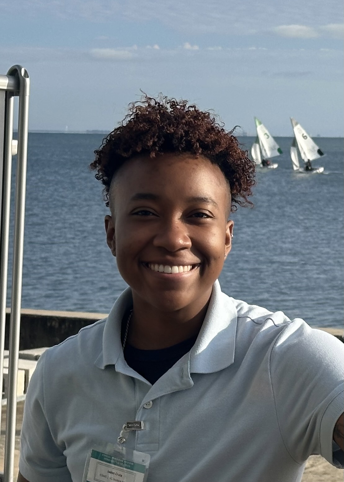
Mechanical Engineer
Jaden was born and raised in South Florida, ultimately moving to Tampa to pursue a bachelor’s degree in mechanical engineering. Through an undergraduate advisor, they learned about the Marine Engineering field and quickly decided to explore it further. In January 2023, Jaden joined COMIT to work on refurbishing and building out an uncrewed surface vehicle known as TREVOR. They were tasked with working to get the vehicle back in working condition, and to a point where it could be controlled both remotely with a joystick controller and autonomously using waypoints. Moving forward, the goal is to explore mapping vehicle applications for the vehicle, such as the ability to gather bathymetric data using multibeam sensors and report back to create a visual model. A completely new 2.0 version of the vehicle is also in the works.
Alastair Graham, PhD
Co-PI
Graham has 13 years of experience as a marine geophysicist with specialties in seafloor mapping and sub-surface geophysical survey, particularly in polar environments. He has participated in 9 major Antarctic ship-based field expeditions and had hands-on experience in mapping, processing, and interpreting datasets from manned (ROVs) and unmanned (AUVs) vehicles, in deep water and under-ice environments. He is currently a co-PI on the 5-year, $50 million NSF-funded International Thwaites Glacier Collaboration (ITGC), working most recently alongside Swedish collaborators on geological interpretations of geophysical data collected with a state-of-the-art Kongsberg HUGIN AUV.
Sarah Grasty, MS
Outreach & Education Manager
Ms. Grasty has 10 years of outreach and informal education experience and most recently held project management and scientific research roles with COMIT’s predecessor, the Continental Shelf Characterization, Assessment and Mapping Project (C-SCAMP). She now manages COMIT’s education and outreach efforts including website content, social media, quarterly newsletters, community outreach efforts. She’s also the lead for COMIT’s crowdsourced bathymetry program, Crowd the Bay. Ms. Grasty additionally co-founded USF CMS’s Guardians of the Gulf outreach program with colleague, Kristen Kusek. Guardians provides fun, multisensory marine science and coastal resiliency programming geared towards underserved youth.
Kristopher Krasnosky, PhD
 Senior Research Associate
Dr. Krasnosky has over 10 years experience in mapping, modeling, remote sensing, and robotics. He has a doctorate in ocean mapping and 8 years of field experience aboard oceanographic vessels. Kris has developed many technologies such as machine-learning bathymetric modeling software, real time ROV/AUV high-resolution mapping packages, and cutting edge mapping vessels. Through his graduate and academic career, he worked as a licensed captain on vessels in the Great Lakes, Hawaii, and Atlantic Coast.
Nicole Raineault, PhD
Co-PI
Dr. Nicole Raineault is the Chief Scientist for the Florida Institute of Oceanography, home to the Florida Coastal Mapping Program (FCMaP) office. As a member of the FCMaP Science and Technical Advisory Council, she aids in the coordination of mapping efforts with the broader FIO consortium and FCMaP members, including COMIT. Prior to joining FIO/USF, Dr. Raineault was the Chief Scientist and Vice President of Exploration and Science Operations with the Ocean Exploration Trust, the non-profit organization that owns and operates the ocean exploration vessel (E/V) Nautilus, where she spent many years mapping the world’s seafloor. She received her Ph.D. from the University of Delaware in geological sciences, earned a Master of Science in Oceanography from Rutgers University and a Bachelor of Science in Marine Science from the University of Maine. Nicole also held a post-doctoral fellowship at the University of Rhode Island, Graduate School of Oceanography.
Yunfang Sun, PhD
Research Associate
Dr. Yunfang Sun is a physical oceanographer with over 10 years of experience in studies of computational fluid dynamics and ocean modeling, dynamics of coupled oceanic-atmospheric modeling, estuary and coastal ocean processes, and coupled physical-biological modeling. Dr. Sun is currently responsible for the new high-resolution WFCOM modeling.
Sieu-Cuong San, PhD
Post-Doc
Prior to joining the Ocean Circulation Lab (OCL), Dr. San worked on large-scale climate dynamics in the Pacific Ocean. He utilized observations and numerical models (the Community Earth System Model) to investigate the primary mechanisms of tropical climate variability from interannual to decadal timescales. At USF, Dr. San focuses on the implementation of a wave module into the existing nowcast/forecast systems. He then uses the models to investigate wave-current interactions
Robert Weisberg, PhD
Co-PI
Weisberg has 44 years of experience combining field operations with modeling to better understand ocean systems. He and his team operate the offshore and estuarine circulation aspects of the COMPS Program. This includes real-time observations from an array of moored buoys and daily, automated nowcast/forecast circulation models for the continental shelf and estuaries of the eastern Gulf of Mexico, plus a very high resolution (20m) model for Tampa Bay. These models have been applied to hurricane storm surge and waves, transport of materials and biota (e.g. red tide tracking), and oil from the Deepwater Horizon spill. His models also include high-resolution bathymetry and coastal geomorphology.