What is a Benthic Habitat Map?
A benthic habitat map depicts the habitats that exist on the seafloor and it includes both geologic and biologic components. The geologic components are essentially the substrate that the seafloor is made of (e.g. sand or rock) as well as the geoforms that describe the structure of an area (e.g. ledge, sand waves). The biologic components of habitat include the organisms that live on the seafloor such as sponges, corals, and sea urchins.
Habitat mapping in the ocean can also be layered to include other components such as what fish, invertebrates, and vegetation are present and in what abundance as well as the physical parameters of the surrounding water column. More about these components can be found in NOAA’s Coastal and Marine Ecological Classification Standard which describes the approach to habitat classification taken by this project.
How do we Create Benthic Habitat Maps?
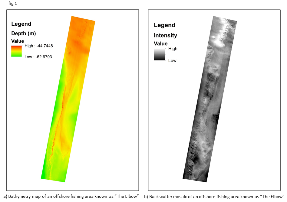
On land, habitat maps can be created directly by looking at photographs taken from satellites. In the ocean, however, we can only get images of small subset of the total area (often called groundtruth points) using visual sampling technologies like the C-BASS towed video system. We therefore must use sound to collect information about the larger area; multibeam echosounders collect both bathymetry and backscattering information by emitting and receiving sound waves. Bathymetry is the depth of the seafloor and collecting it gives us a map of the seafloor’s topography (fig 1a). From bathymetry we can determine various other aspects of the seafloor including the slope and roughness. Backscattering is a measurement of how strong the sound returns which can give information about how hard or soft the seafloor is, giving us an indication of substrate (fig 1b).
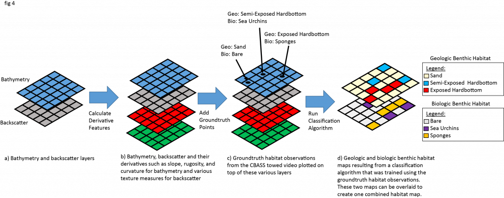
Although these maps can help us better understand and identify key features in an area, they are not benthic habitat maps as they don’t explicitly tell us what the geologic and biologic aspects of benthic habitat are at a given point. These “sound maps” must be converted into categories that are more intuitive for humans to understand. A human observer can identify habitats using the C-BASS camera (figs 2 and 3).

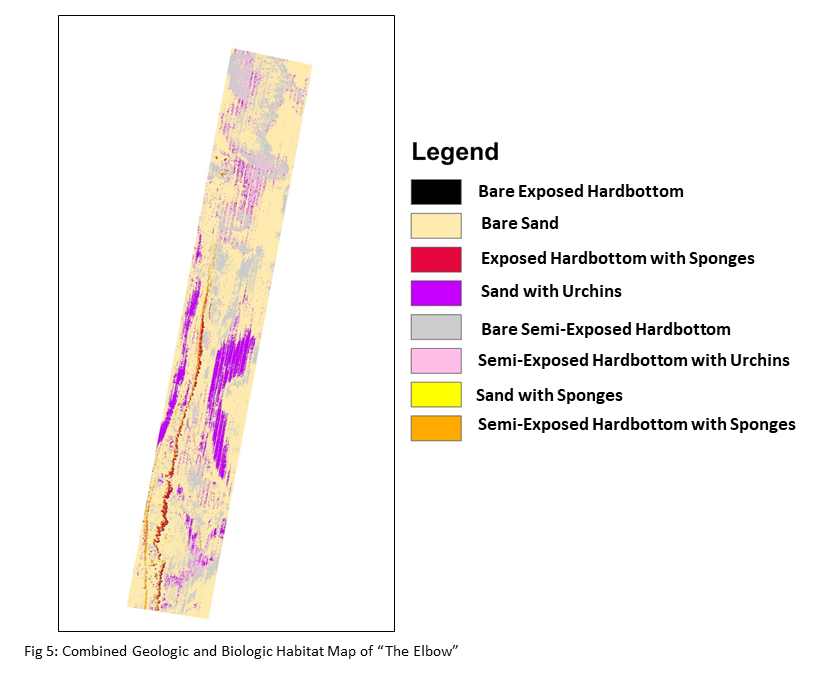
These groundtruth points can then be plotted on the “sound maps” and used to train a computer algorithm to identify what each habitat type typically looks like in terms of these “sound maps “ in order to create predicted geologic and biologic benthic habitat maps for the entire area (fig 4). The two resulting maps can also be overlain to create one combined benthic habitat map (fig 5).
Why do we Need Benthic Habitat Maps?
Benthic habitat maps are a critical for the sustainable management of resources in our oceans. Benthic habitat maps are important when siting offshore development so as not to harm high value habitats. Benthic habitat maps are also important for fisheries management because both the geologic and biologic aspects of benthic habitat act to create unique structures and environments that support different fish communities. Understanding these relationships and the locations of these habitats allows for the objective determination of Marine Protected Areas and Essential Fish Habitat, as well as better sampling design and more accurate estimates of fish abundance.