 DISCLAIMER: The Continental Shelf Characterization, Assessment and Mapping Project (C-SCAMP) requests that it be referenced as the originator of this dataset in any future products or research derived from these data. These data are scientific in nature and should not be used for navigation or any purposes relating to safety at sea. As such, the Continental Shelf Characterization, Assessment and Mapping Project (C-SCAMP) will not be held accountable for any injury, loss, or damage resulting from their misuse.
If any of the following map products are used in any presentations, reports, etc., please use contact us at cscampdata (at) usf (dot) edu and also use the citation below:
Murawski, S., Gray, J., Brizzolara, J., Hommeyer, M., and Lembke C. Pinellas County Artificial Reefs [map]. “Artificial Reef Data Products.” Funding provided by the National Fish and Wildlife Foundation (NFWF): GEBF Grant #45892. Last updated October 2018. <https://www.marine.usf.edu/scamp/data-products/artificialreefs> (Date Accessed).
To download GoogleEarth-compatible files for all artificial reefs mapped by C-SCAMP as of December 2018, please click here. A step-by-step guide on how to import these files can be found here!
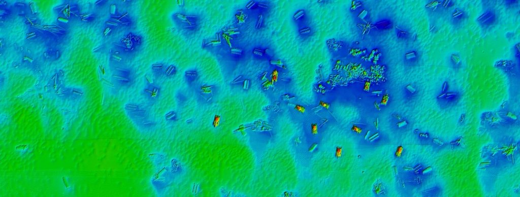
St. Pete Beach Reef
Below are several file types which can be used with GIS programs and Google Earth (KML). Please email cscampdata (at) usf (dot) edu with any questions or requests for a different file type.
1. BAG file
2. GeoTIFF
3. KML
In order to view the files for download below (.csar), you must have CARIS EasyView installed. This is a free program that can be downloaded here. Both files #1 and #2 must be downloaded for the surface to open properly in EasyView.
Using EasyView, you can view this file in 3D and “fly” through the bottom features which is depicted in the video at the right.

