DISCLAIMER: The Continental Shelf Characterization, Assessment and Mapping Project (C-SCAMP) requests that it be referenced as the originator of this dataset in any future products or research derived from these data. These data are scientific in nature and should not be used for navigation or any purposes relating to safety at sea. As such, the Continental Shelf Characterization, Assessment and Mapping Project (C-SCAMP) will not be held accountable for any injury, loss, or damage resulting from their misuse.
Murawski, S., Lembke C., Gray, J, Brizzolara, J., and Hommeyer, M. The Southwest Florida Middle Grounds [map]. Data collected 2016-2018. 4×4-m grid. “Southwest and West Florida Middle Grounds Data Products.” Last updated June 2018. Retrieved from: http://www.marine.usf.edu/scamp/data-products/swfmg. Funding provided by the National Fish and Wildlife Foundation (NFWF): GEBF Grant #45892.
Compiled data from the SWFMG as of June 2018:
To download a KML file (Google Earth) depicting the depth contours for the SWFMG and WFMG, please click here.
For GIS program compatible GeoTIFFs, please click here.
Older datasets are below:
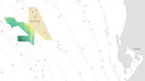
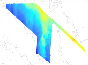 During our summer field season in 2016, we mapped an area southwest of the Florida Middle Grounds (example image at right). Over the course of three 5 day cruises, we mapped approximately 575 square km. Below you can download a .bag file which can be used in Arcmap and a GeoTIFF. Both of these surfaces display 4×4 meter grids and the depth range is 33 – 67 meters.
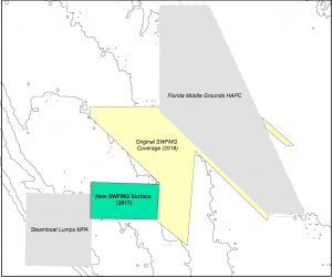
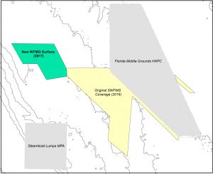
In July 2017, we mapped additional areas west and south-west of the Florida Middle Grounds (blue areas in images below). We have a GeoTIFF image available for download as well as a KML for use in Google Earth.
SWFMG 4×4 meter GeoTIFF Image (WGS 1984 UTM Zone 16)
WFMG 4×4 meter GeoTIFF Image (WGS 1984 UTM Zone 16)
